MAP
Survey Map
SP006292
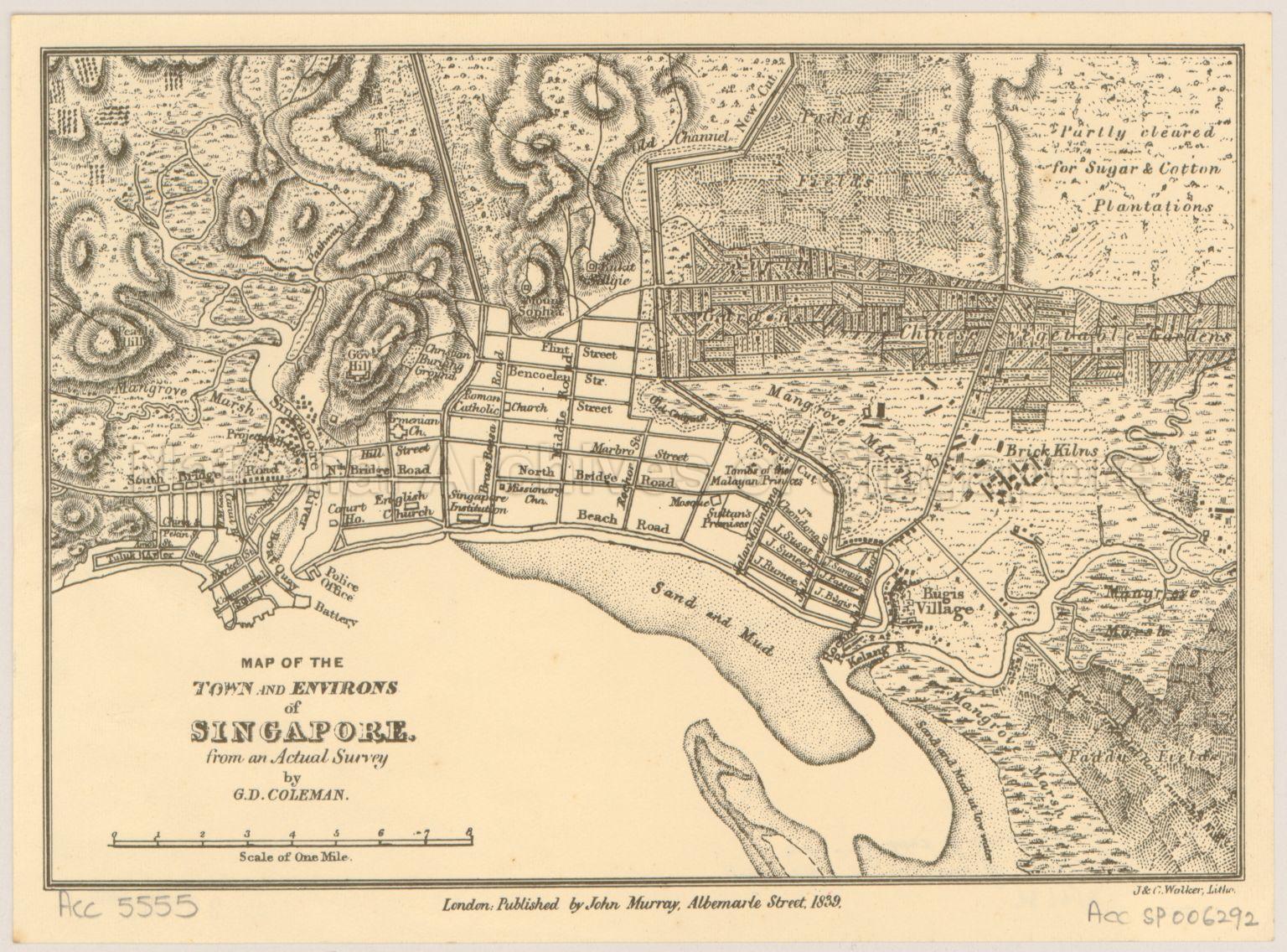
Map of the Town and Environs of Singapore from an Actual Survey by G.D. Coleman
1839
Map of the Town and Environs of Singapore from an Actual Survey by G.D. Coleman shows physical landscape, land use, vegetation, land partially cleared for sugar and cotton plantations, brick kilns, paddy fields, mangrove marshes, Bugis Village, and others, in and around the Singapore River, Kallang River and Rochor River
20120001608 - 0012
John Murray, Albemarte Street, London
Viewing permitted. Use and reproduction only with permission.
Processing of requests may require 3-5 working days
