MAP
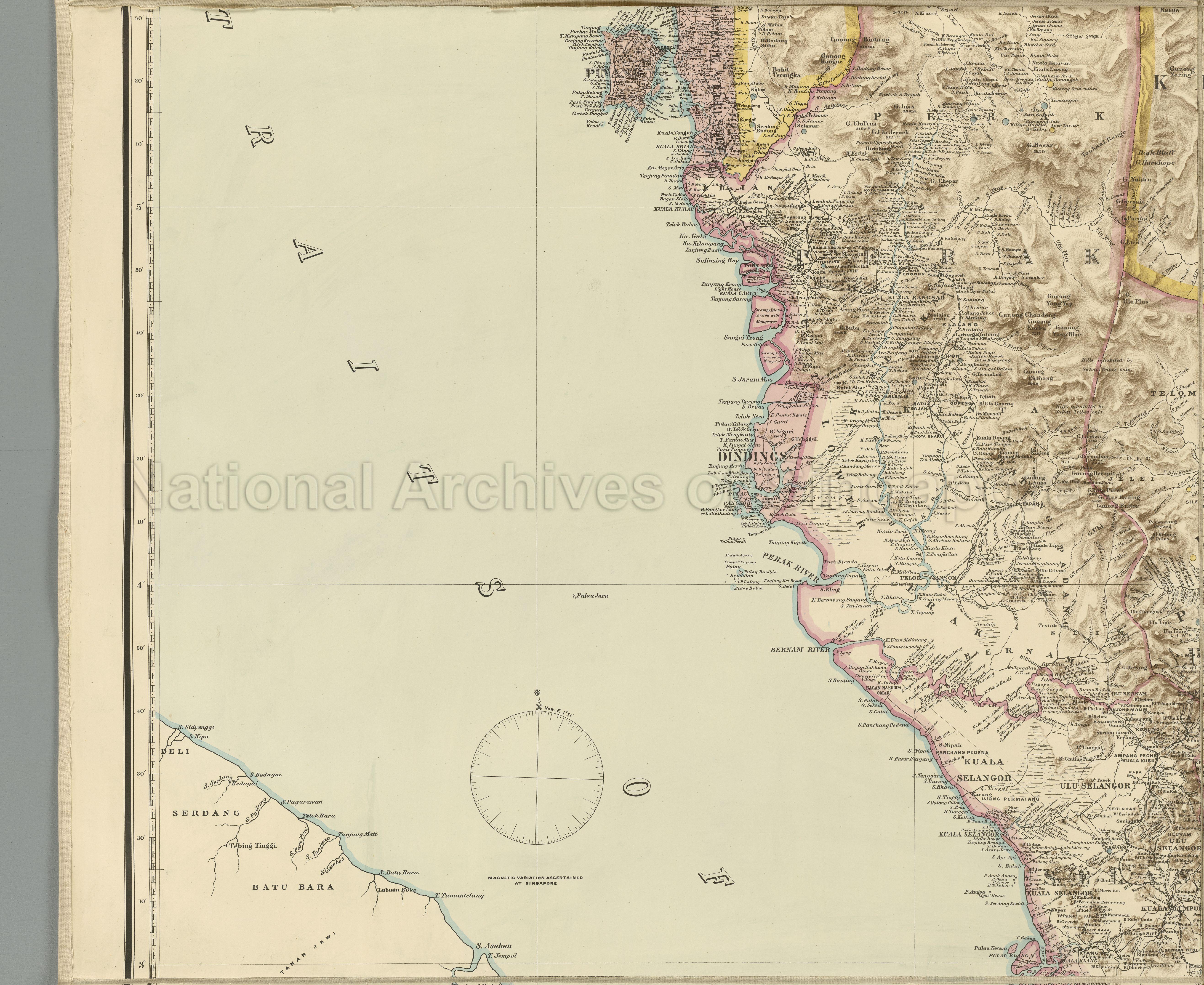
Topographical Map
D2017_000065_2_NAN
A Map of The Malay Peninsula 1898
21/10/1898
Map shows part of Siamese States (edged yellow) of Kedah or Sai Buri and Kelantan (presently States of Malaysia), and Federated Malay States, under British Protection (edged pink), of Perak, Selangor and Pahang, all bordered by undefined boundaries or with boundaries along rivers, British Territories (coloured light pink) of Pinang, Province Wellesley and Dindings, railways, proposed railways, cart roads, bridle roads and paths, rivers and streams, swamps, islands, gold and tin locations, highland shading, towns, kampongs, Krian River, Perak River, Kinta River, Bernam River, Klang River, Kuala Lumpur, Telok Anson, Ipoh, Kuala Kangsar, Port Weld, Thaiping (Taiping), George Town, Butterworth, and others
20050000682 - 0009_D2017_000065_2_NAN
Miko_1578 LM
Middle left portion of set of maps D2017_000065_1 to D2017_000065_6_NAN
Similar map found in TM000405_3 and D2018_000149_2_RGS
Similar map found in TM000405_3 and D2018_000149_2_RGS
Compiled by and published for the Straits Branch of the Royal Asiatic Society
Prepared and drawn by John van Cuylenburg
Published by Edward Stanford
Prepared and drawn by John van Cuylenburg
Published by Edward Stanford
Application for use (and request for copies) has to be made directly with copyright owner.
Any request for use or reproduction of the map, please contact info@nationaalarchief.nl.
Processing of requests may require 3-5 working days
