MAP
Topographic Map
TM000003
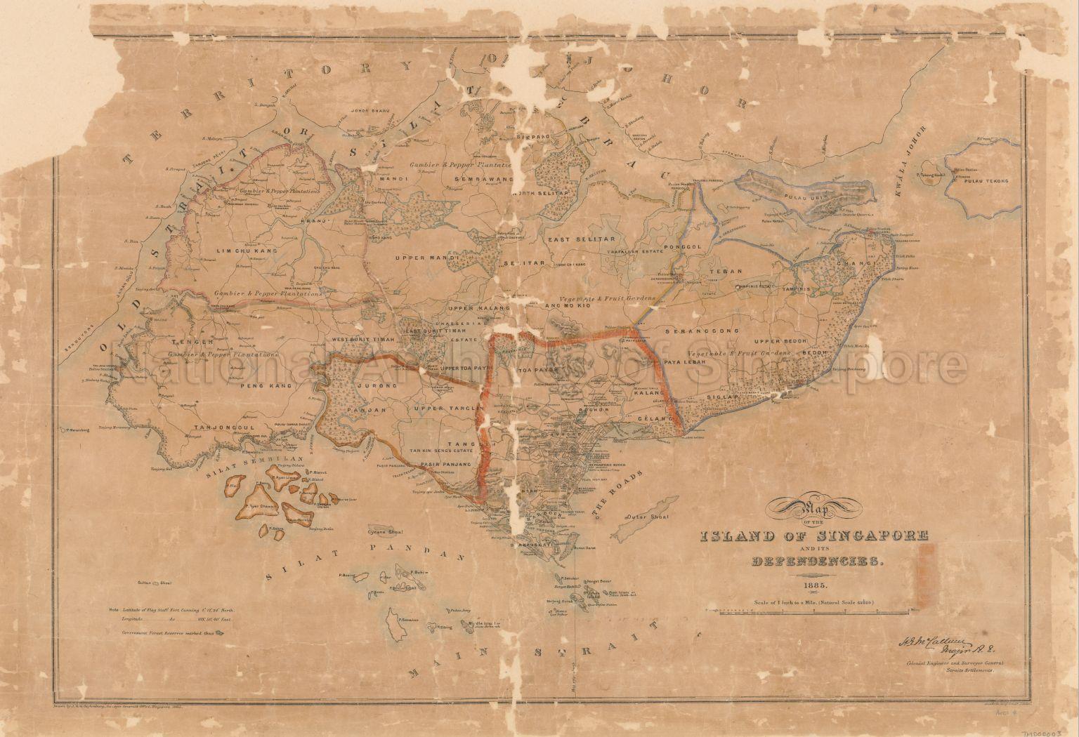
Map Of The Island Of Singapore And Its Dependencies
1885
Map Of The Island Of Singapore And Its Dependencies
Map showing boundary of the British and Dutch residencies of Singapore and Rhio, Old Strait or Silat Tambrau, Kwala Johore, physical landscape, land use, forests, swamps, pepper and gambier plantations, coconut plantations, villages, rivers, and others
Map showing boundary of the British and Dutch residencies of Singapore and Rhio, Old Strait or Silat Tambrau, Kwala Johore, physical landscape, land use, forests, swamps, pepper and gambier plantations, coconut plantations, villages, rivers, and others
20120001646 - 0005
English
Survey Department, Singapore
Prepared and published by J. Von Cuylenburg, Surveyor-General's Office, Singapore, Major H. E McCallum, Colonial Engineer and Surveyor-General, Straits Settlements (S.S.)
Prepared and published by J. Von Cuylenburg, Surveyor-General's Office, Singapore, Major H. E McCallum, Colonial Engineer and Surveyor-General, Straits Settlements (S.S.)
Viewing permitted. Use and reproduction only with permission.
Old accession number: 4
Credit line: Singapore Land Authority collection, courtesy of National Archives of Singapore
Credit line: Singapore Land Authority collection, courtesy of National Archives of Singapore
Processing of requests may require 3-5 working days
