MAP
Survey Map
SP006866
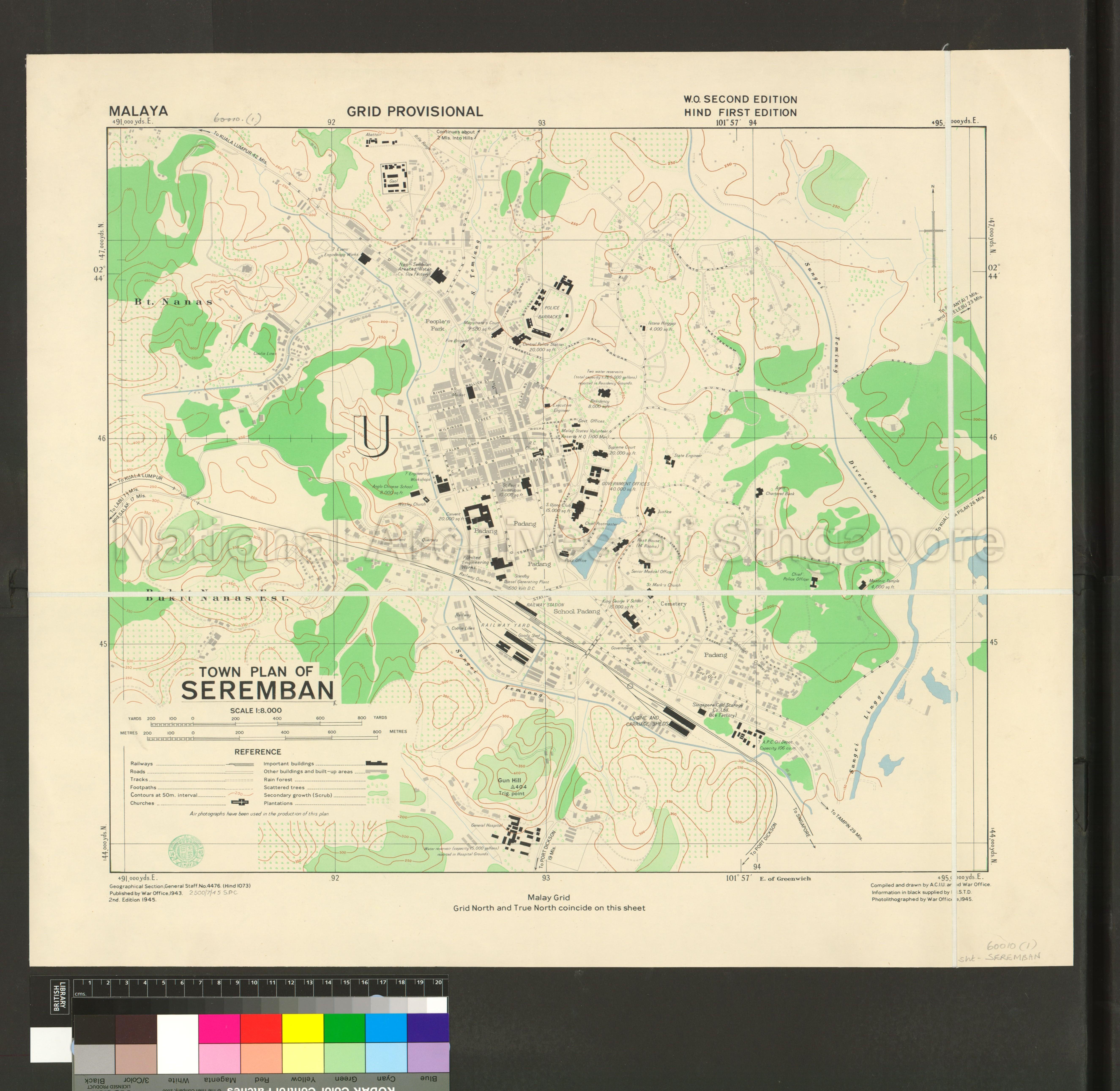
Malaya. Town Plan of Seremban
1945
Malaya. Grid Provisional. Town Plan of Seremban
Shows physical landscape, land use, reservoirs, forest, plantations, buildings, schools, government buildings, railway station, churches, padang, coolie lines, abattoir, gaol, roads leading to Port Dickson, Kuala Pilah, Jelebu, Kuala Lumpur, Labu, Salak; Negri Sembilan Aerated Water Company (Ice Factory), Magistrate Court, Central Police Station, Istana Hinggap, Bukit Nanas Estate, Sungei Temiang, Sungei Linggi, and others
Shows physical landscape, land use, reservoirs, forest, plantations, buildings, schools, government buildings, railway station, churches, padang, coolie lines, abattoir, gaol, roads leading to Port Dickson, Kuala Pilah, Jelebu, Kuala Lumpur, Labu, Salak; Negri Sembilan Aerated Water Company (Ice Factory), Magistrate Court, Central Police Station, Istana Hinggap, Bukit Nanas Estate, Sungei Temiang, Sungei Linggi, and others
20050000918 - 0002_c7336-04_SP006866
60010(1) c7336-04 HIND 1073 2500/7/45 S P C Second Edition
Published by War Office, First Edition in 1943
Geographical Section, General Staff, No. 4476
Geographical Section, General Staff, No. 4476
Viewing permitted. Commercial use and reproduction require written permission from copyright owner or source.
Copies and reproductions can only be made for the purpose of educational/academic research, private study and scholarship with proper citation of The British Library (BL) as the original source. Any other uses or commercial uses such as illustrative use in publications such as books, magazines or online, or in exhibition displays require permission from The British Library and this will involve a permission fee and correct citation. To use the map in this context, please complete the online application form at http://www.bl.uk/reshelp/atyourdesk/permissions/permission.html or contact BL’s Permissions department at permissions@bl.uk
Processing of requests may require 3-5 working days
