MAP
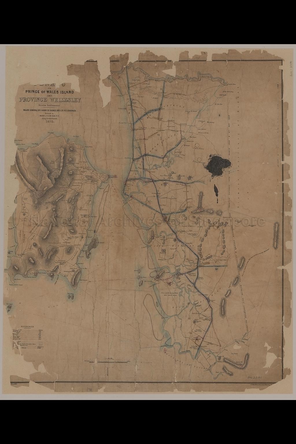
Topographic Map
TM000756
Map Of Prince Of Wales Island And Province Wellesley, Straits Settlements
1870
Map shows boundaries, contours, physical landscape, land use, rivers, villages, names of places, towns, roads, hills, rice fields, sugar estates, Brown and Nairnes Sugar Estate, Muda District, Telok Ayer Tawar District, Pry District, Juru District, Kreen District, and others
20080000021 - AccNo2241
English
Edward Stanford Lithographer
London Major General Sir Harry Saint George Ord, Governor. Revised by Major J.F.A.McNair, Acting Surveyor General
London Major General Sir Harry Saint George Ord, Governor. Revised by Major J.F.A.McNair, Acting Surveyor General
Viewing permitted only. No reproduction is allowed.
Old accession number: 2241.
Credit line: Singapore Land Authority collection, courtesy of National Archives of Singapore
Credit line: Singapore Land Authority collection, courtesy of National Archives of Singapore
Processing of requests may require 3-5 working days
