MAP
Survey Map
SP002901
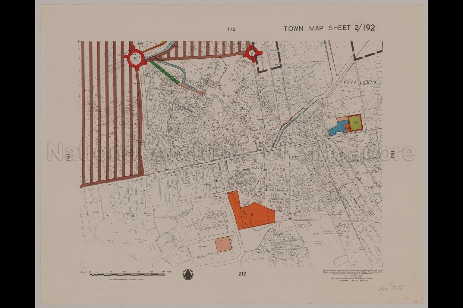
1958 Master Plan: Town Map Sheet 2/192
01/11/1966
1958 Master Plan: Map shows Paya Lebar, planning district boundary, Mukim boundary, comprehensive development area, green belt, hospital site, markets, permanent residential area, drainage channel, local shopping area, school site, cinema, major traffic junctions, geylang River, Hollywood Theatre, Queen Cinema, Singapore Hotel, Yock Eng Chinese School, Maha Bodhi School, Kong Hwa Chinese School, Montbatten School, Dunman Government Chinese School, School, Geylang Serai Village, Kampong Ubi, Siong Lim Park, Punah Place, Aljunied Road, Paya Lebar Road, Geylang Road, Changi Road, Guillemard Road, Airport Road, Dunman Road, and the surroundings
20050000972 - 0005
Sheet Number 2_192
English
Part of a set of maps from SP002839 to SP002913
Chief Surveyor, Singapore. Planning Department, Ministry of Law and National Development
Viewing permitted. Use and reproduction require written permission from copyright owner.
Seek permission from URA for reproduction
Processing of requests may require 3-5 working days
