MAP
Topographic Map
TM000761
Cameron Highlands
1936
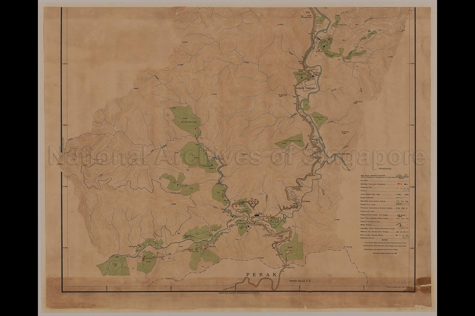
Third section of map covers part of Cameron Highlands with its border state of Perak, showing boundaries, contours, land use, buildings, schools, roads, new telephone line, rivers, swamps, blukar, vegetable gardens, fruit trees, tea plantations, coffee farms, flower gardens, nurseries, cooly lines, embarkments, trigonometrical stations, Kuala Ringlet Falls, Hill View Farm, Ferdis Farm, Folly Farm, Three Mountain Estate, Lubok Garden, Kilat Gardens, Cameron Highlands Club, Ringlet, Chittering Brook, The Glen, Sungei Bertam, Sungei Ringlet, Ringlet Pass, Circular Path and others
20080000022 - AccNo2257_3
Federated Malay States Surveys Number 154_1936
Maps in 3 sections TM000759 to TM000761
Surveyor-General, Federated Malay States (F.M.S.) and Straits Settlements (S.S.)
Viewing permitted only. No reproduction is allowed.
Old accession number: 2257/3. Credit line: Singapore Land Authority collection, courtesy of National Archives of Singapore
Processing of requests may require 3-5 working days
