MAP
Survey Map
SP001558
Fraser's Hill
1947
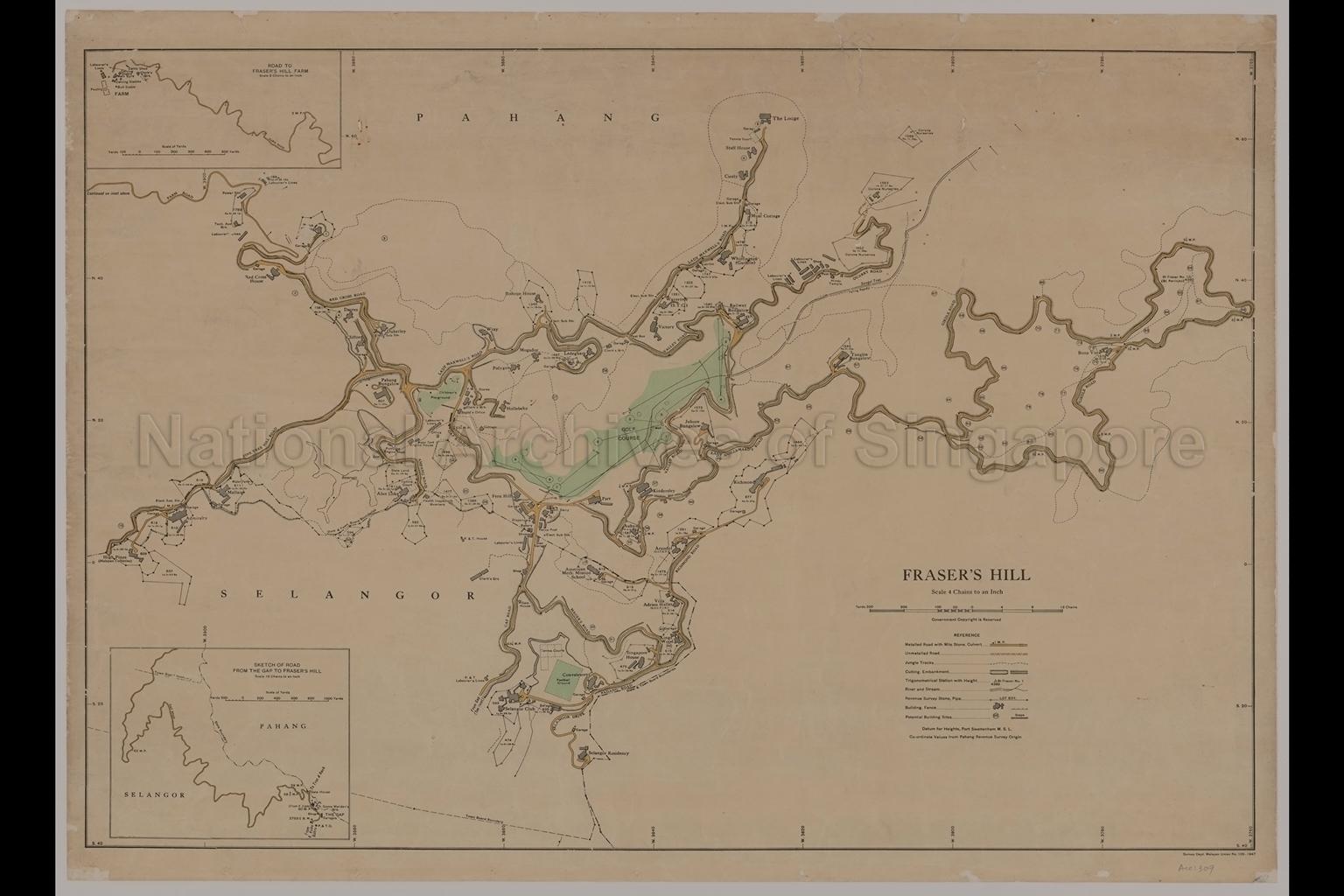
Fraser's Hill. Pahang, Malaya
Map shows Pahang/Selangor state boundary, town boundary, road system, milestones, jungle tracks, embankments, Bukit Fraser No. 1 Trigonometrical Station, Sungei Tras, buildings, lot boundaries with lot numbers and areas in acres, roods and poles, garages, labourer's lines, police post, govenment dairy, electric sub-stations, shops, bakery, dispensary, tennis courts, football ground, cottages, golf course, children's playground, P. W. D. (Public Works Department) stores, superintendant's office, power station with techical assistant's quarters, Corona Nurseries, Hindu temple, The Lodge, Red Cross House, Bishops House, American Methodist Mission School, Singapore House, Johore Bungalow, Tanglin Bungalow, Pahang Bungalow, Railway Bungalow, Selangor Club, Selangor Residency, Fern Hill, meteorological station, reservoir, Gap Road, Valley Road, Lady Maxwell's Road, Ampang Road, Pine Tree Hill Road, Red Cross Road, Farm Road, Quarry Road, Lady Guillemard's Road, Girdle Road, Richmond Road, Mager's Road, Padang Road, Selangor Drive, and others. Two insets, (1) at 16 chains to an inch scale, showing the road (Gap Road) from The Gap to Fraser's Hill, and (2), at 8 chains to an inch scale, showing the road (Farm Road) to Fraser's Hill Farm
Map shows Pahang/Selangor state boundary, town boundary, road system, milestones, jungle tracks, embankments, Bukit Fraser No. 1 Trigonometrical Station, Sungei Tras, buildings, lot boundaries with lot numbers and areas in acres, roods and poles, garages, labourer's lines, police post, govenment dairy, electric sub-stations, shops, bakery, dispensary, tennis courts, football ground, cottages, golf course, children's playground, P. W. D. (Public Works Department) stores, superintendant's office, power station with techical assistant's quarters, Corona Nurseries, Hindu temple, The Lodge, Red Cross House, Bishops House, American Methodist Mission School, Singapore House, Johore Bungalow, Tanglin Bungalow, Pahang Bungalow, Railway Bungalow, Selangor Club, Selangor Residency, Fern Hill, meteorological station, reservoir, Gap Road, Valley Road, Lady Maxwell's Road, Ampang Road, Pine Tree Hill Road, Red Cross Road, Farm Road, Quarry Road, Lady Guillemard's Road, Girdle Road, Richmond Road, Mager's Road, Padang Road, Selangor Drive, and others. Two insets, (1) at 16 chains to an inch scale, showing the road (Gap Road) from The Gap to Fraser's Hill, and (2), at 8 chains to an inch scale, showing the road (Farm Road) to Fraser's Hill Farm
20050000691 - 0012
Survey Department, Malayan Union No. 109_1947
English
Survey Department, Malayan Union
Viewing permitted. Use and reproduction only with permission.
Old accession number: 309
Credit line: Singapore Land Authority collection, courtesy of National Archives of Singapore
Credit line: Singapore Land Authority collection, courtesy of National Archives of Singapore
Processing of requests may require 3-5 working days
