MAP
Aviation Map
AM000005
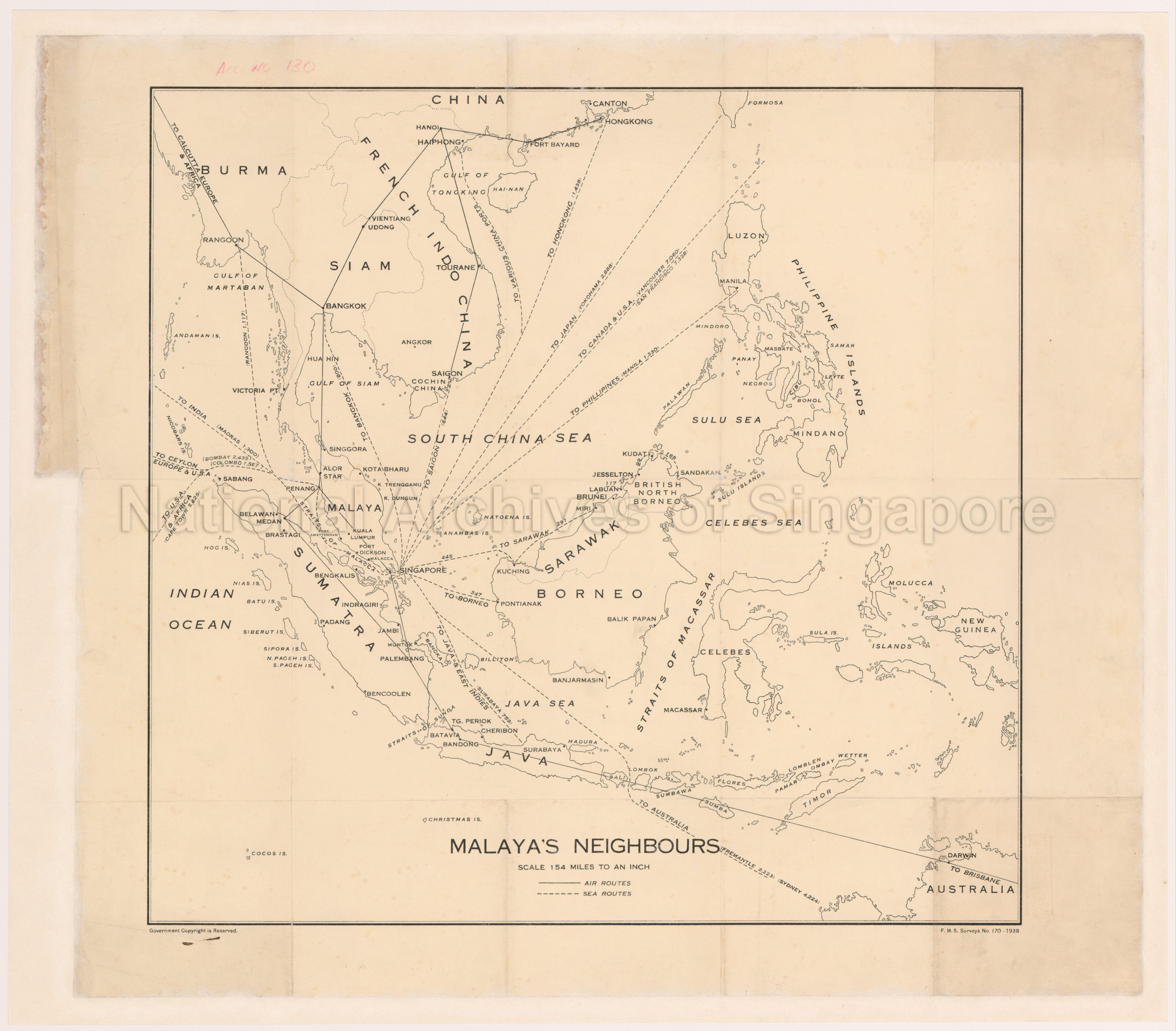
Malaya's Neighbours
1938
Malaya's Neighbours
Map covers Southeast Asia showing air and sea routes with distances, mostly radiating from Singapore to countries such as Burma, Siam, French-Indo China, China, Philippine Islands, Australia, Indonesia, Brunei, Sarawak and British North Borneo, and ports like Rangoon, Bangkok, Saigon, Hanoi, Hongkong, Manila, Jesselton, Kuching, Pontianak, Miri, Dawin, Batavia, Bandong, Palembang, Medan, Penang and others.
Map covers Southeast Asia showing air and sea routes with distances, mostly radiating from Singapore to countries such as Burma, Siam, French-Indo China, China, Philippine Islands, Australia, Indonesia, Brunei, Sarawak and British North Borneo, and ports like Rangoon, Bangkok, Saigon, Hanoi, Hongkong, Manila, Jesselton, Kuching, Pontianak, Miri, Dawin, Batavia, Bandong, Palembang, Medan, Penang and others.
20050000689 - 0039_AccNo130
Federated Malay States Surveys No. 170_1938
Similar map in AM000006 but in different condition
Surveyor-General, Federated Malay States (F.M.S.) and Straits Settlements (S.S.)
Viewing permitted. Use and reproduction require written permission from copyright owner.
Seek permission from SLA for use and reproduction.
Old accession number: 130
Credit line: Singapore Land Authority collection, courtesy of National Archives of Singapore
Old accession number: 130
Credit line: Singapore Land Authority collection, courtesy of National Archives of Singapore
Processing of requests may require 3-5 working days
