MAP
Topographic Map
TM000012
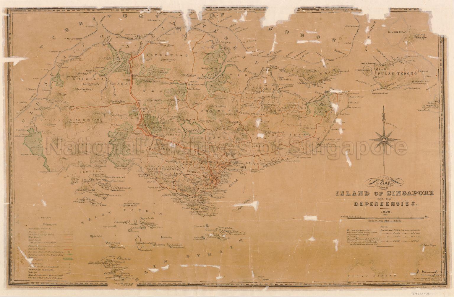
Map Of The Island Of Singapore And Its Dependencies 1898
1898
This map provides detailed topographical information on the island of Singapore and its surrounding islands in the last decade of the 19th Century. The old name of the Strait of Johor - "Old Strait or Selat Tebrau" is used in the map. Landmarks in and around Singapore's central district are also detailed in the map e.g. Tan Tock Seng Pauper Hospital, St Andrew's Cathedral, General Hospital etc.
20120001647 - 0009
English
Similar maps in TM000012_1, GM000440, GM000441 and GM000445 but in different condition
Prepared and drawn by John Von Cuylenburg, Surveyor-General's Office, Singapore.
C.E. Mice, Colonial Engineers and Surveyor General, Straits Settlement
C.E. Mice, Colonial Engineers and Surveyor General, Straits Settlement
Viewing permitted. Use and reproduction only with permission.
Old accession number: 13
Credit line: Singapore Land Authority collection, courtesy of National Archives of Singapore
Credit line: Singapore Land Authority collection, courtesy of National Archives of Singapore
Processing of requests may require 3-5 working days
