MAP
Survey Map
D2016_000309
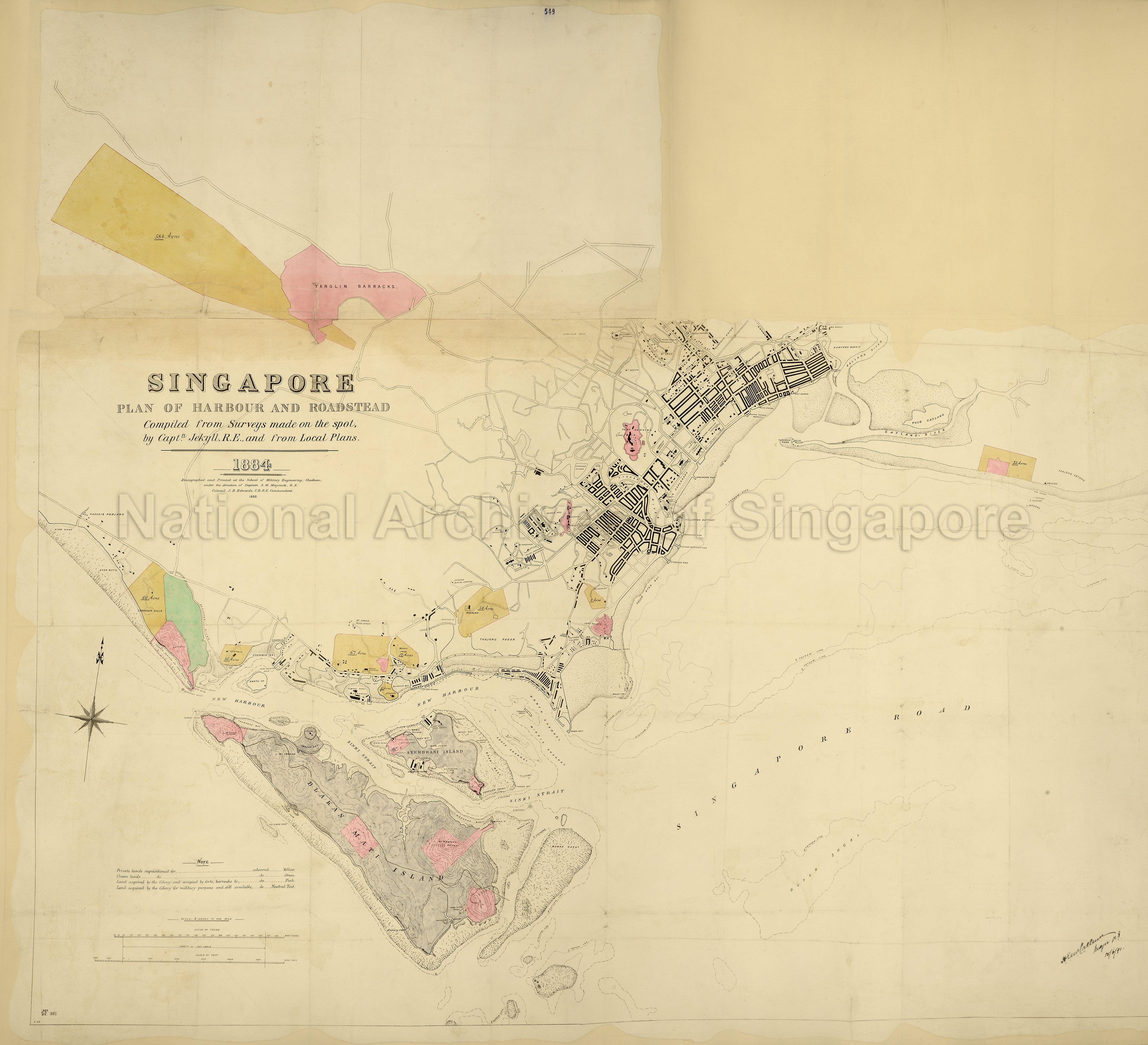
Singapore. Plan of the Harbour and Roadstead
1891
Plan of harbour and roadstead. Compiled from surveys made on the spot, by Captain Jekyll, RE and from local plans 1884'. Reference table to land acquired by the Colony for military purposes and to private and Crown lands requisitioned for. Compass indicator. Zincographed and printed at the School of Military Engineering, Chatham, under the directions of Captain S M Maycock and Colonel J B Edwards, 1885. Signed: Major H E McCallum, Royal Engineers, 15 June [18]91. Originally enclosed with despatch number 250 from Governor Sir C Smith, Straits Settlements, 15 June 1891.
From public record Office: Maps and plans extracted to rolled storage from various series of records. Straits Settlements: Singapore.
From public record Office: Maps and plans extracted to rolled storage from various series of records. Straits Settlements: Singapore.
2016HDD0001 - 0390_MR1_1143_3
MR 1/1143/3
Public Record Office
Viewing permitted. Commercial use and reproduction require written permission from copyright owner or source.
Copies and reproductions can only be made for the purpose of educational/academic research, private study and scholarship with proper citation of The National Archives (TNA) as the original source. Any other uses or commercial uses such as illustrative use in publications such as books, magazines or online, or in exhibition displays require permission from The National Archives and this will involve a display fee and correct citation. To use the map in this context, please contact The National Archives image library at : image-library@nationalarchives.gov.uk
Processing of requests may require 3-5 working days
